




* Please check and strictly abide by local laws and regulations before any flight.
** All data on this page were measured using a DJI Matrice 350 RTK production model in a controlled test environment. Actual experience may vary depending on the environment, usage, and firmware version.
1. The 6kg load is measured at the third gimbal connector under sea-level conditions. The load capacity decreases as the altitude increases. For details, please refer to the official user manual.
2. Measured with the aircraft flying forward at a constant speed of 10 m/s in a windless environment at sea level, carrying only the H30T (total weight of 10670 g), and with the battery level from 100% down to 0%. Data is for reference only. Actual experience may vary depending on the environment, usage, and firmware version.
3. Power line obstacle sensing capability: When directly facing a transmission line (21.6 mm steel-cored aluminum conductor), obstacle sensing is supported at speeds up to 25 m/s. When both transmission lines (21.6 mm steel-cored aluminum conductor) and distribution lines (12 mm steel-cored aluminum conductor) are present, obstacle sensing is supported at speeds up to 17 m/s. Obstacle sensing performance may vary depending on environmental conditions (such as clouds, fog, rain, or snow), as well as the material, location, and shape of the object to be sensed. Due to the limitations of the safety system, the aircraft cannot actively avoid rapidly moving objects; please fly with caution in such environments. Please refer to the user manual for more information. The mmWave radar feature is not available in some countries/regions.
4. This function is not available in countries or regions without 5GHz frequency band support. For more information, please refer to local laws and regulations.
5. The allowed operating frequency varies in different countries and regions. For more information, please refer to local laws and regulations.
6. Measured with the aircraft hovering in a windless environment at sea level, carrying only the H30T (total weight of 10670 g), and with the battery level from 100% down to 0%. Data is for reference only. Actual usage time may vary depending on the flight mode, accessories, and environment.
7. Please follow the requirements stated in the instructions for IP55 protection rating. Data obtained in a controlled environment. The IP rating is not permanently effective and may decrease due to product wear and tear.
8. Purchase separately.
9. DJI FlightHub 2 is required.
10. It is recommended to use when the ship speed is less than 10 knots and the wind speed is less than 5 m/s; exercise caution in other environments. It is recommended to reserve a 3 m × 3 m takeoff and landing space on the deck. Standard landing point model files can be obtained from the download page.
11. To use the optimized 4G transmission, the remote controller must be equipped with the DJI Cellular Dongle 2 (sold separately) or connected to the internet via Wi-Fi. The service is not available in some countries and regions. Please consult your local dealer for more details.
DJI Matrice 400 Plus Combo
DJI Matrice 400 Plus Combo
TB100 – BS100 Not included in the kit
DJI Matrice 400
Professional drone for advanced inspections with LiDAR, thermal camera and long flight time
The DJI Matrice 400, also known as DJI M400 or simply DJI 400, is the latest professional drone platform developed by DJI Enterprise. It is a highly advanced industrial drone, designed to meet the most complex needs of sectors such as power line inspection, public safety, topographic surveys, photogrammetry, inspections and renewable energy.
With a flight time of up to 59 minutes, a payload capacity of up to 6 kg and advanced sensors such as rotating LiDAR, mmWave radar and infrared thermal camera, the DJI Matrice 400 is the ideal choice for those looking for an inspection drone, a thermal imaging drone, a laser scanner drone, or a photogrammetry drone.
The new era of DJI Enterprise's heavy-lift drone
DJI has introduced the DJI Matrice 400, a new generation drone platform designed to revolutionize advanced commercial operations. Conceived to tackle complex missions with multiple payloads, the M400 establishes itself as the industry standard for long-range operations, heavy payload transport, environmental sensing, and professional automation.
A drone designed for critical missions
The DJI M400 is a high-performance platform, capable of flying for up to 59 minutes, carrying payloads of up to 6 kg and connecting up to 7 payloads simultaneously. Thanks to the integrated LiDAR and the combination of mmWave radar, color fisheye visual sensors and 3D infrared detection, the M400 can detect subtle obstacles such as power lines even in low visibility conditions.
Furthermore, the drone can operate in complex scenarios, such as takeoffs and landings on ships, and is compatible with the DJI Airborne Relay system, further extending its operational capabilities.
Compatible payloads and advanced modularity
The Matrice 400 is compatible with the latest and most sophisticated DJI payloads:
-
Zenmuse H30 / H30T: for visual and thermal inspections with AI detection
-
Zenmuse L2: for LiDAR surveys with power line tracking
-
Zenmuse P1: for high-precision 3D acquisitions and photogrammetry
-
Zenmuse S1 / V1: LEP projector and speaker for night and public operations
-
Manifold 3: onboard computer with 100 TOPS AI power for local processing
The drone has E-Port V2 ports (including the E4 expansion to 4 additional ports), which make it possible to connect up to 7 devices simultaneously. Third-party PSDK payloads, originally developed for the DJI M350 RTK, are also supported.
Flight performance and autonomy
The DJI M400 stands out for its extraordinary flight endurance:
| Payload Configuration | Estimated Flight Time |
|---|---|
| H30T / L2 / P1 Only | Up to 59 minutes |
| H30T + V1 | Approximately 53 minutes |
| H30T + S1 | Approximately 50 minutes |
| 3 kg Payload | Approximately 44 minutes |
| Maximum Payload (6 kg) | Approximately 31 minutes |
In addition to long endurance, the Matrice 400 offers a horizontal speed of up to 25 m/s, an ascent speed of 10 m/s, and a descent speed of 8 m/s, making it extremely efficient for covering large areas in reduced time.
Maximum safety and reliability
Safety is an absolute priority for the M400, which is equipped with an advanced sensor suite:
-
Rotating LiDAR (520,000 points/sec, 360° horizontal / 58° vertical)
-
Six-directional mmWave radar
-
Color fisheye vision for visual assistance in flight
-
Top LiDAR for overhead obstacle detection
-
Downward-facing 3D infrared sensor
This combination ensures safe flight even in adverse environmental conditions, such as fog, rain, or nighttime environments, with the ability to accurately detect thin objects, such as suspended cables or critical structural elements.
Robustness and advanced transmission
The DJI M400 is built to tackle harsh environments:
-
IP55 protection rating
-
Operating temperature from -20°C to +50°C
-
O4 Enterprise transmission system with a range of up to 20 km (CE)
-
Support for FlightHub 2 system, also in On-Premises version, for centralized and remote workflows
The drone can also function as an aerial repeater, creating a bridge between an operational drone and the control station in complex scenarios such as mountainous areas or isolated industrial sites.
DJI Matrice 400 Technical Specifications
The DJI Matrice 400 specifications place this model among the most performing professional drones on the market:
-
Maximum flight time: up to 59 minutes
-
Maximum payload: 6 kg
-
Flight speed: up to 25 m/s
-
IP55 protection: resistant to rain and dust
-
Operating temperature: from -20°C to +50°C
-
Video transmission: up to 40 km with O4 Enterprise system
-
Advanced anti-obstacle system: detects power cables even in the dark or in adverse weather conditions
-
Support for multiple payloads: Zenmuse H30, L2, P1, S1, V1, Manifold 3 and third-party loads
-
Compatible with DJI FlightHub 2, DJI Terra and DJI Modify
Why choose DJI Matrice 400
The DJI Matrice 400 is a high-end DJI drone that combines reliability, autonomy, and artificial intelligence to optimize every mission. It is particularly suitable for those seeking:
-
A DJI drone with thermal camera for search and rescue or industrial thermal inspection
-
A LiDAR survey drone and laser scanner for topographic and civil applications
-
An industrial inspection drone, including for critical infrastructures such as power lines and bridges
-
A professional photogrammetry drone, thanks to compatibility with Zenmuse P1 and DJI software
-
A reliable drone even in extreme environments, including offshore operations
The DJI Matrice 400 drone supports a wide range of accessories and modules to extend operational capabilities:
-
DJI RC Plus 2 Enterprise: remote controller with high-brightness screen
-
TB100 Batteries and intelligent charging stations
-
DJI Cellular Dongle 2 for 4G transmission
-
D-RTK 3 for high-precision positioning
-
Full support for SDK, PSDK, MSDK, and Cloud APIs for custom development
Safety Features
The DJI M400 is equipped with a range of integrated safety mechanisms. These include:
- Horizontal rotating LiDAR, with a point frequency of 520,000 points per second and a field of view of 360° (horizontal) and 58° (vertical).
- Six-directional mmWave radar.
- Colour fisheye vision system that provides colour-assisted flight images for safe operations.
- Top LiDAR.
- Downward 3D infrared sensing system.
This robust safety suite significantly enhances the drone's obstacle sensing capability; it allows for the detection of thin and small power lines, even in low light conditions or at night; and provides stable performance in all conditions, including rain, fog, or limited visibility.
Essentially, they combine to provide the drone with 24/7 obstacle detection, as shown in the table below.
| Feature | Safety Benefit |
|---|---|
| LiDAR | Detects small obstacles, such as power cables.
Reliable positioning in denied or weak GNSS signal conditions. Excels in long-range detection. Stable performance in varying light conditions. |
| Radar | Wide detection range.
Penetrates fog, rain, and snow: ideal for operations in low visibility conditions. Quickly provides real-time distance and speed data. |
| Colour Fisheye | Longer detection range.
High light sensitivity object detection in daylight. Captures complex visual features, such as colour, shape, and texture, for improved object recognition. Supports visual positioning in denied GNSS conditions. |
This is an effective package of features that significantly enhances safety.
For example, flying at 25 m/s, the drone can detect and avoid primary power lines (21.6 mm) when flying directly towards them, while at 17 m/s, it can detect and avoid primary (21.6 mm) and secondary (12 mm) lines.
Operators can also benefit from the drone's brake and obstacle avoidance mode.
In addition, the M400 is equipped with a range of additional safety features.
| Safety Feature | Description |
|---|---|
| Arm Lock Detection | If the sleeves are not correctly locked, a notification will be displayed on the Pilot 2 app, and the aircraft will not take off. |
| Battery Lock Sensor | If the flight battery is not correctly installed, a notification will be displayed on the Pilot 2 app, and the aircraft will not take off. |
| Anti-Collision Beacon | The drone is equipped with two anti-collision beacons to improve night visibility. |
| Three-Propeller Emergency Landing | In the event of a motor failure, the aircraft can automatically enter a three-propeller emergency landing mode. The aircraft will rotate quickly and descend slowly.
Please note: takeoff weight: ≤10.8 kg; flight height: ≥80 m. |
| AirSense ADS-B Receiver | Collects flight data automatically sent by nearby aircraft equipped with ADS-B transmitters, analysing it to detect potential collision risks and alert users in advance via the Pilot 2 app. |
Enhanced Transmission
The DJI M400 features the advanced O4 Enterprise transmission system, supporting video transmission up to 20 km (CE, as well as SRRC and MIC) or an impressive 40 km (FCC), for increased stability, improved signal strength, and more reliable feeds.
The aircraft features a 10-antenna system and a high-gain phased array antenna system on the remote controller, and also supports video transmission in the sub-2G frequency band. Please note that the sub-2G band may vary by region.
Operators can also benefit from two enhanced 4G transmission modules. When equipped with two DJI Cellular Dongle 2s, the M400 can automatically switch to the best available network, providing a more stable signal in urban environments with interference or in remote regions.
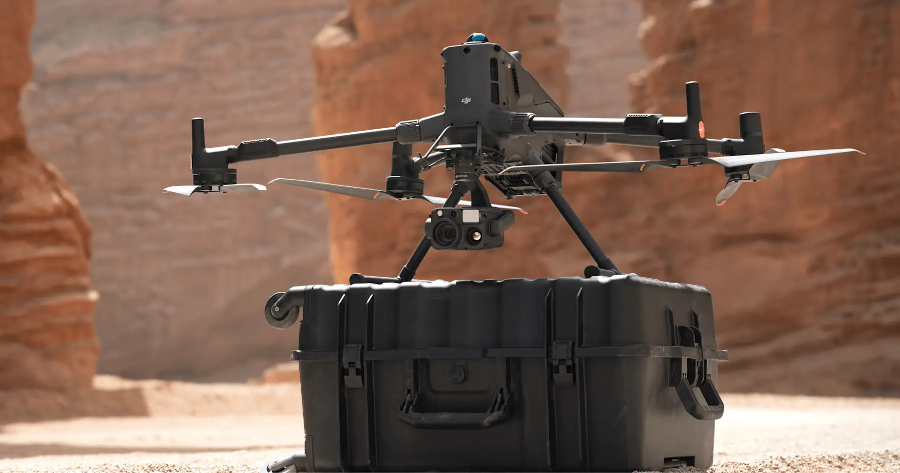
In addition, the M400 can be used as part of an aerial transmission system.
In this scenario, an M400 can act as a repeater drone, flying at high altitude to provide relay signals to another M400 operating at a greater distance.
This significantly extends the transmission range: ideal for search and rescue missions or inspections in mountainous areas.
The workflow is as follows:
- Complete the connection setup between the mission drone and the repeater drone on the ground.
- Worker drone: displays the relay drone's battery level, RTH time, transmission signal, and relative position.
- Relay Drone: displays the distance and direction to the mission drone in real-time.
The table below provides an overview of which aircraft in the DJI Enterprise ecosystem can be used as worker and relay drones.
| Worker drone | Worker drone | Worker drone | |
|---|---|---|---|
| Relay Drone | M400 | M4 | M4D |
| M400 | ✓ | ✓ | X |
| M4D | Coming soon | ✓ | ✓ |
Robust Performance in Harsh Weather
The DJI M400 is a robust drone, designed to withstand harsh weather conditions.
It has an IP55 rating, ensuring reliable flights in challenging environments, including heavy rain, dust, and fog. DJI states that it can withstand rainfall of 100 mm in 24 hours.
The DJI M400 can also operate reliably in extreme temperatures, flying at temperatures ranging from -20°C to 50°C.
It also features a wind resistance of 12 m/s.
Intelligent Features
The DJI M400 is equipped with intelligent features that enhance mission safety and effectiveness.
These features are described in the table below, divided into Smart AR Projection, Intelligent Flight Routes, and AI Detection.
Smart AR Projection
| Intelligent Feature | Description |
|---|---|
| AR Power Line | During activities such as power grid inspection, the obstacle sensing system detects frontal obstacles represented by cables and displays easily recognizable AR lines on the remote controller screen. |
| AR Map Display | When operating in urban areas, the remote controller can display building names and landmarks in real-time, marking main roads with highly visible lines. |
| AR Flight Route | Real-time route preview is available for the drone during RTH, obstacle detection, and FlyTo operations. |
| Real-time Annotations | Without modeling, you can mark points to obtain subject locations, draw lines to measure distances between multiple points, and outline areas to calculate their dimensions.
Measurement results can be synced to DJI FlightHub 2. |
| RC Signal Direction Request | When the connection between the aircraft and the remote controller is weak, a directional indicator appears on the compass at the bottom of the screen, showing the relative position of the aircraft and the remote controller. |
Intelligent Flight
| Intelligent Feature | Description |
|---|---|
| Cruise | You can pilot the drone in a specific direction without constantly pressing the control sticks, simplifying long-distance flights or linear inspections. |
| Fly To | The drone can automatically adapt its flight trajectory and speed based on the surrounding environment, successfully reaching a designated position without manual adjustments. |
| POI | Enables continuous observation and 3D modeling of buildings during orbital flight around a designated area, significantly enhancing the efficiency of fixed-point observation and modeling tasks. |
| Real-time Terrain Tracking | Enable this function during manual and automatic flight paths in any horizontal direction, ensuring a stable relative height to the ground.
During search and rescue operations, keep the size of objects on the ground uniform on the screen, reducing the need for frequent zoom adjustments. Maintain consistent GSD during mapping missions. |
| Observed View | Records the ground area and the screen's center position observed by the camera and displays the observed view area on the map.
Combined with the cruise control function, it can significantly reduce the cognitive load on the pilot engaged in search and rescue. |
| Intelligent Track | For precise subject positioning and automatic zoom adjustments.
Allows for easy subject switching. It can automatically reacquire a subject, even if briefly obscured. |
AI Detection
| Intelligent Feature | Description |
|---|---|
| Visible Detection (with DJI Zenmuse H30 series) | AI models for people, vehicles, boats.
Supports alarming and counting. Adjustable confidence level. Supports third-party models. |
| Thermal Detection | AI models for people, vehicles, and wild boars.
Supports moving person detection. Adjustable confidence level. |
Flight Routes
| Intelligent Feature | Description |
|---|---|
| Slope and Geometric Route | Matrice 400 supports slope and geometric route planning and execution via DJI Pilot 2 or DJI FlightHub 2.
Ideal for surveying building facades, slopes, or other inclined surfaces. |
| Smart 3D Capture (with DJI Zenmuse P1) | Create a rough model on the RC, which will then be used to create an automated Smart 3D acquisition path. |
Takeoff and Landing on Ships
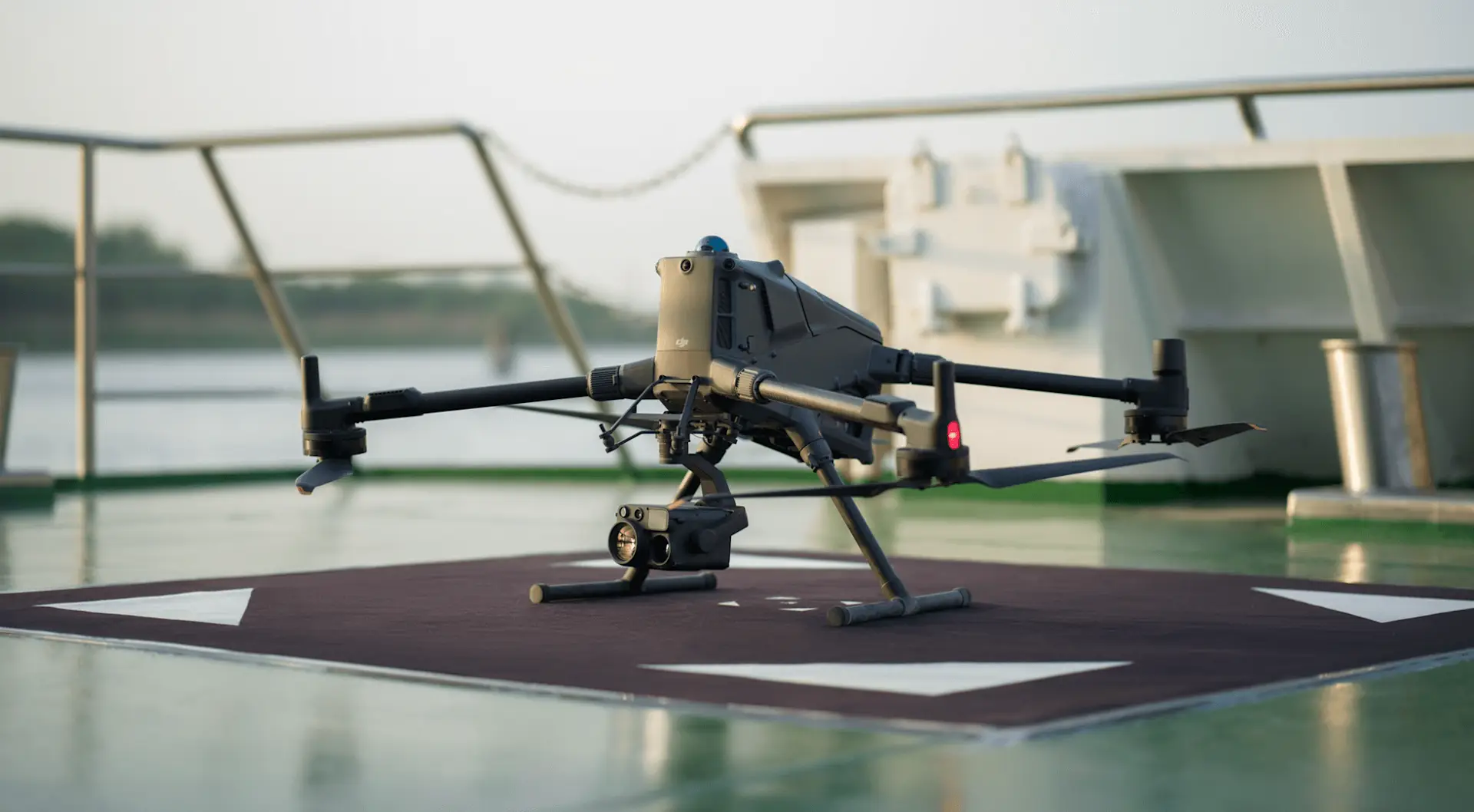
The DJI M400 supports automatic landing on ships.
This allows the drone to recognize custom landing markers on the ship's deck, enabling dynamic landings even on moving vessels.
This expands operational coverage, reduces launch and recovery risks, and opens up new possibilities for offshore missions.
It helps meet the growing demand for drones at sea, in applications such as maritime patrols and offshore wind turbine inspections.
DJI M400 Accessories
The DJI M400 is compatible with a vast ecosystem of accessories, such as the DJI RC Plus 2 Enterprise Enhanced Version, the TB100 Intelligent Flight Battery, the BS100 Multifunctional Battery Station, the Airport Carrying Case, the new TB100C Wired Drone Battery, and Manifold 3.
Below, we will analyze each of these accessories.
DJI RC Plus 2 Enterprise Enhanced Version
- 7.02-inch touchscreen LCD.
- Maximum brightness of 1400 nits.
- High-gain antenna array.
- IP54 protection rating.
- Supports button backlighting.
- 3.8 hours of built-in battery life.
- 7 hours of total operation with the external WB37 battery.
- An optional 4G enhancement module can be mounted on the RC, ensuring stable transmission in combination with the drone's two 4G modules.
- The latest sub-2G antenna enables 1.4 GHz and 900 MHz transmission bands.
- The antenna status indicator shows real-time operating status.
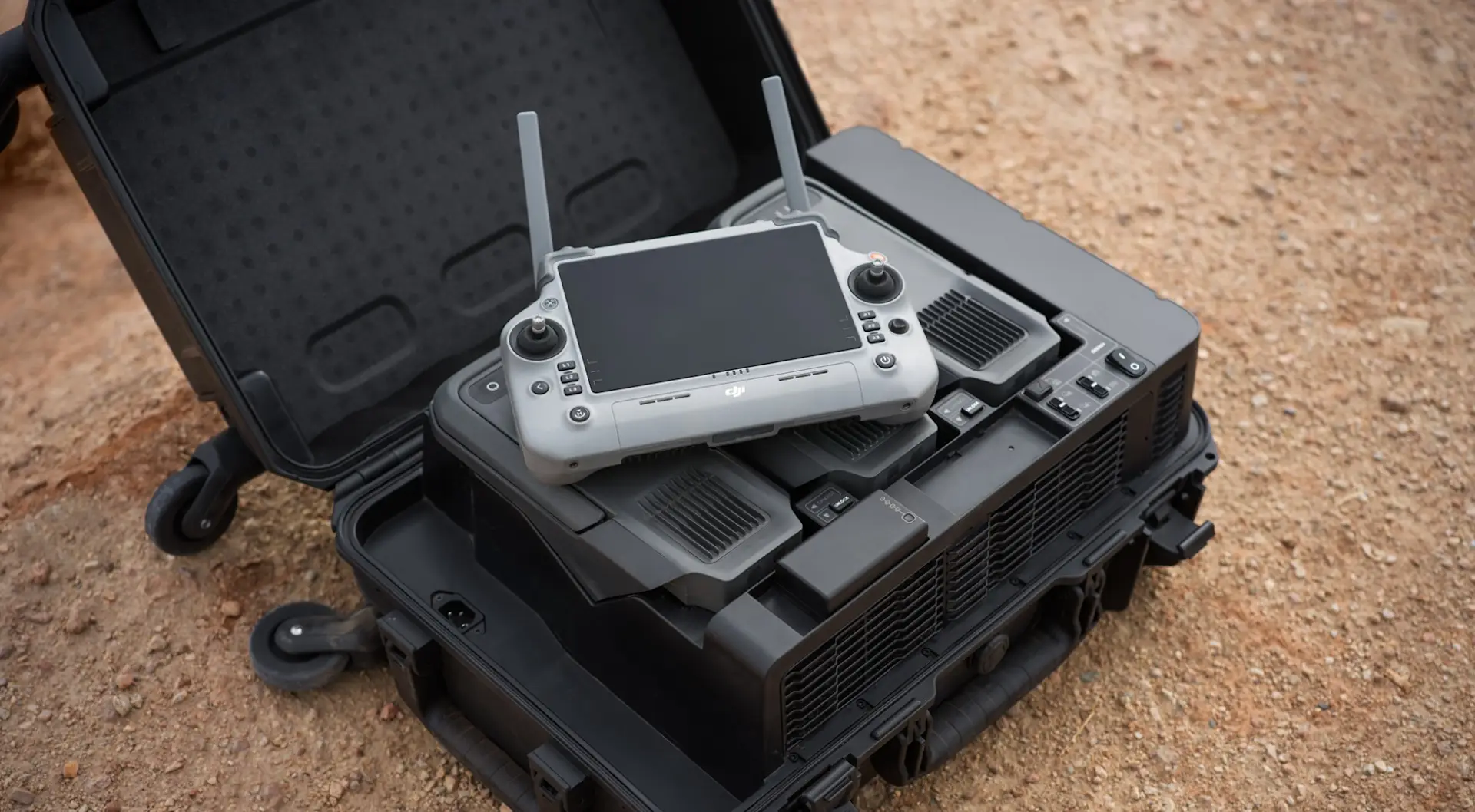
The difference between DJI RC Plus 2 Enterprise and DJI RC Plus 2 Enterprise Enhanced is that the former is equipped with the DJI RC Plus 2 Sub-2G transmission module, which supports Sub-2G communication bands.
The DJI RC Plus 2 Enterprise Enhanced remote controller can also be used to support DJI M350 RTK, DJI Matrice 4 Series, Mavic 3 Enterprise Series, and Mavic 3D Enterprise Series drones, but these models do not support the Sub-2G communication band, and Mavic 3 Enterprise Series and Mavic 3D Enterprise Series must be updated to version 14.1 to support linking the models.
TB100 Intelligent Flight Battery
- High-capacity battery (20,254 mAh).
- Top-insertion design allows for quick insertion and removal.
- 13S Li-ion.
- 977 Wh energy.
- 400 cycles.
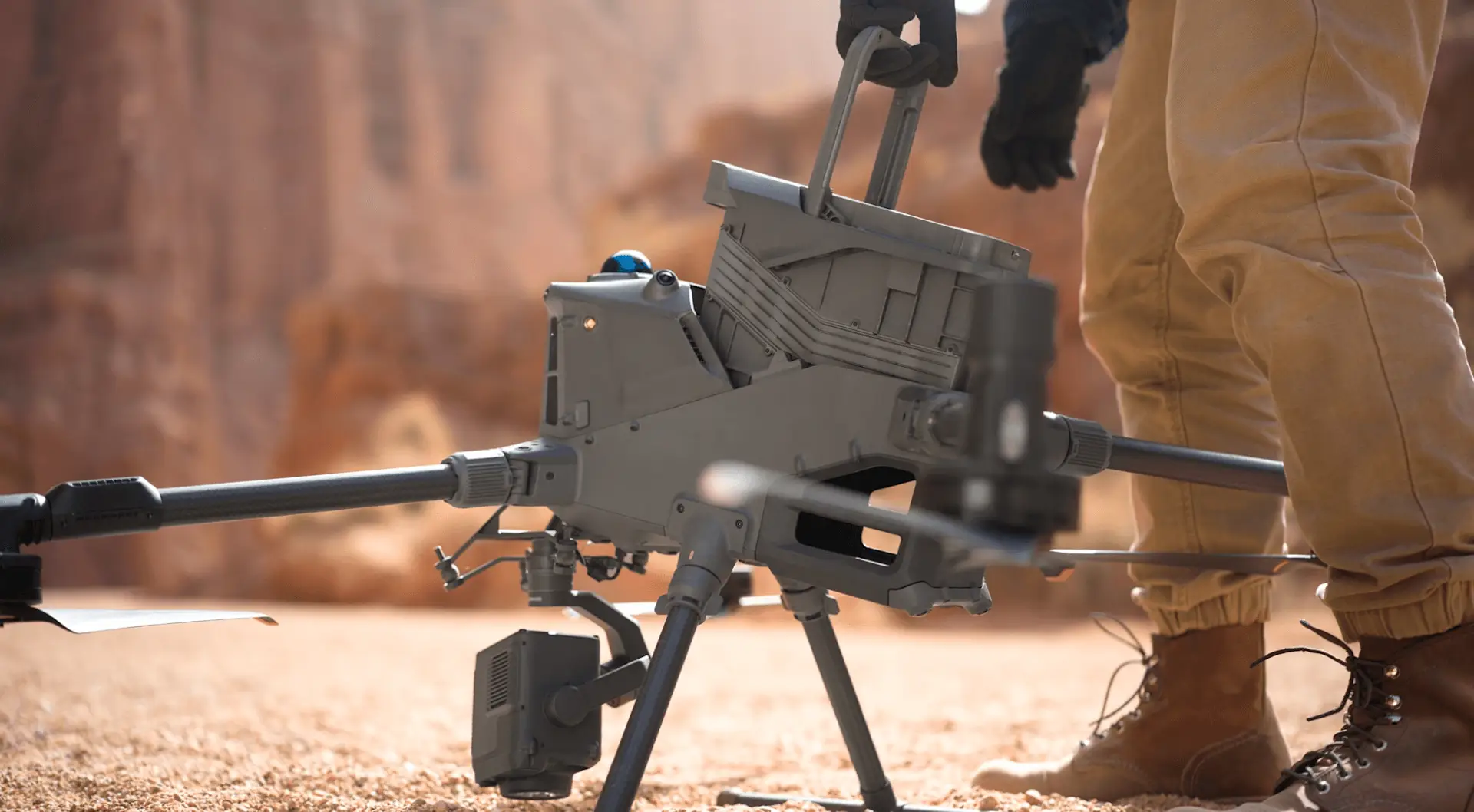
Hot-swapping is also supported when pairing the TB100 with the M400.
- The M400 is equipped with integrated capacitors to maintain power for up to 45 seconds during main module battery replacement, allowing for a quick restart.
- Upon restart, the drone maintains its satellite connection, allowing missions to resume quickly without having to reacquire GPS.
BS100 Multifunctional Charging Station
- Supports up to 3 TB100 batteries and 2 WB37 batteries.
- Charge level modes: Standby – 90%; Standard – 100%.
- Speed modes: Fast mode: 0 to 100% in 45 minutes at 220V, 70 minutes at 110V; Quiet mode: 0 to 100% in 110 minutes at 220V and 110V.
- Connects to the remote controller for charging station management.
- Supports comprehensive battery status monitoring.
- One-tap setting for automatic discharge and firmware updates.
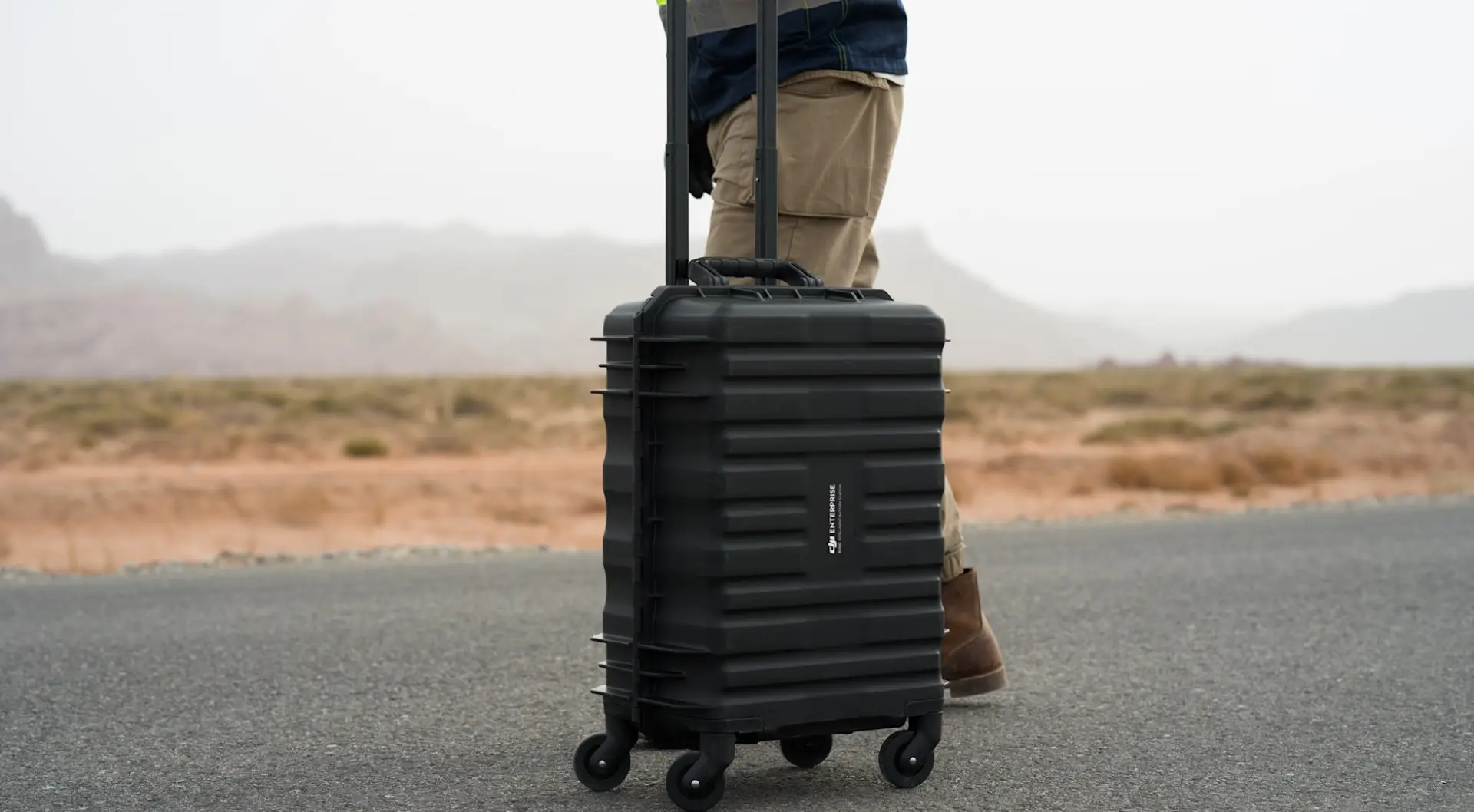
Aircraft Carrying Case
- Dimensions: 779 x 363 x 528 mm.
- Equipped with omnidirectional wheels at the bottom.
- Includes propeller foam.
The case is optimized for maximum space and can hold:
- M400 aircraft with front and rear propeller holders.
- 1 remote controller.
- Up to 2 TB100 flight batteries.
- 1 x payload (e.g., H30 series, L2
- 1 x Zenmuse S1 spotlight
- 1 x Zenmuse V1 speaker.
- 2 WB37 batteries.
These include the TB100 battery with up to 400 charge cycles and the BS100 charging station with support for 3 battery charge cycles.
DJI Manifold 3
- High-performance onboard processing unit.
- Provides up to 100 TOPS of computing power, supporting parallel acceleration via GPU and DLA cores for model inference and edge AI tasks.
- Weighs 120 g.
- Fully supports and is compatible with PSDK V3, for seamless integration with underlying communication protocols and efficient access to flight platform sensor data.
- Third-party developers can leverage Manifold 3's computing power and, through integration with PSDK, create high-performance, end-to-end automated solutions.
TB100C Wired Battery
- The wired battery and third-party ecosystem power supply provide continuous power to the drone.
- Enables long-duration hovering or mission execution, significantly improving operational times and efficiency.
- Capacity 20,254 mAh.
- Supports 400 cycles.
- Supports in-box charging with the BS100 charging station.
DJI M400 Software Compatibility
The DJI M400 is compatible with the DJI software suite, such as DJI Pilot 2, FlightHub 2, DJI Terra, and DJI Modify.
DJI M400 Data Security
Nowadays, data security is a fundamental aspect for enterprise drone operators and UAV programs.
For this reason, the DJI M400 is equipped with a robust data security suite to protect user data, including media encryption, local storage, log deletion, offline firmware updates, and offline maps.
The M400 can also be used in conjunction with DJI FlightHub 2 On-premises, which offers an additional layer of security. The On-premises version of FlightHub 2 allows users to deploy the platform on a server of their choice; to keep flight logs, maps, photos, and videos within the corporate infrastructure; and to manage how data is stored, backed up, and accessed.
Main Applications
The DJI Matrice 400 is an essential tool for professionals in the following fields:
-
Drone for electrical inspections and energy infrastructure
-
Thermal camera drone for emergency and public safety operations
-
Professional lidar drone for topographic surveys and construction
-
Drone for high-precision photogrammetry with Zenmuse P1
-
DJI drone for environmental mapping, precision agriculture, and monitoring
If you are looking for a professional DJI drone capable of offering superior performance, exceptional autonomy, and advanced detection capabilities, the DJI Matrice 400 is the right choice. This model encapsulates the best of DJI Enterprise technology in a single reliable, versatile platform ready for any mission, even the most complex.


